"Go open today, there's no excuse not to" - interview with Timo Aarnio, GIS expert at National Land Survey of Finland.
 Erik Albers
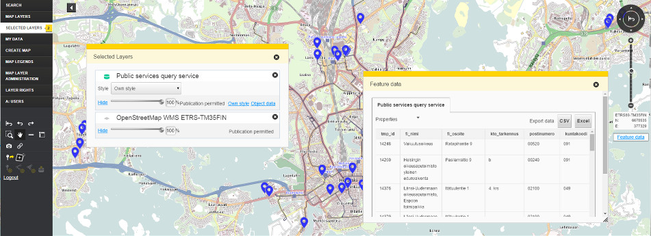
Oskari is a Free Software platform for browsing, sharing and analysing geographic information from distributed data sources. Its development is coordinated by the National Land Survey of Finland and is organised through the Oskari network with over 38 organisations from both the public and private sector. Oskari was awarded second prize in the cross-border category of the European Commission's Sharing and Reuse Awards Contest 2017 and is currently going through incubation phase to become an official Open Source Geospatial Foundation (OSGeo) Project. To shed light on best practices regarding Free Software developed by public funds, we have conducted an interview with Timo Aarnio, GIS Expert at the National Land Survey of Finland’s SDI Services department.
FSFE: Could you briefly explain what “Oskari” is?
Timo Aarnio: Oskari is an open source web map application platform. It can be used to set up services that benefit from or require a map component. Oskari is designed to be used as a part of spatial data infrastructure so that the data is not stored in the Oskari instance but rather fetched from different APIs on-the-fly.

Timo Aarnio works as a GIS Expert at the National Land Survey of Finland’s SDI Services department. With a background in IT Administration, Timo has a lot of experience with open source software especially on the server side. At NLSFI he has been working as a product owner for the Oskari open source software, with a focus on analysis and thematic mapping functions, and as an expert in the INSPIRE implementation with OGC compliant services. Timo’s biggest interests are agile development, user-centered design, and web applications.
What is the main target group for Oskari? Public administrations?
Public administrations are definitely one target group but not the only one. What we would like to see more in the Oskari community is companies offering Oskari related services and training. Most of the public sector organisations do not have the necessary know-how or resources available to set up this kind of a platform product. Companies can obviously benefit by generating revenue, but for others the benefits are wherever a map representation for a dataset can be useful. This is true in a plethora of use cases be it for planning purposes, spatial analysis or just for simply displaying locations of offices with routing integrated, and so on.
What was the initial idea behind creating Oskari?
The idea for Oskari came about when a new geoportal was being planned for Finland. Commercial solutions did not offer enough functionalities to fulfil the needs of the National Land Survey of Finland, so we decided to develop a new software utilising existing open source solutions as much as possible. There was also a desire to try new development methods, like Agile and Scrum.
How did the development of Oskari benefit from existing open source solutions or from collaboration with other projects?
For Oskari we’ve used as many readily available libraries and pieces of software as possible. We use, for example, GeoTools, GeoServer, OpenLayers, PostgreSQL/PostGIS, Redis, just to name a few. Going further, all of our “production line” is based on Free and Open Source Software tools and our production servers also all run Linux. We’ve also been in contact with some similar projects and tried to find ways to collaborate.
All of our “production line” is based on Free and Open Source Software tools and our production servers also all run Linux.
Was there positive feedback from administrations in Finland so far? Do they find new software well fit for their needs?
I think most of the feedback has been positive, but then again I must be biased. If someone doesn’t find the software useful I guess they are not likely to send any feedback, they just move on to the next software. But as Oskari has a lot of organisations using it to fulfil different needs I can safely say that it has been found useful in many cases. Our web page lists multiple public administrations that use Oskari as well as community projects.
In your demo version on demo.oskari.org, you offer a lot of thematic maps and visualised data. Are these based on open data? Where do you get the data from?
The statistical data currently available on demo.oskari.org is open data from Statistics Finland. The data is utilized via an API. Like mentioned before, in typical cases no data is hosted in the Oskari instance itself.
Who are the people or the organisations behind Oskari and how is it financed?
In 2014, the network for Oskari users was established in Finland, today it consists of partners from all over the world, including organisations, individuals and developers. This incudes National Land Survey of Finland, Finnish Transport Agency, The City of Tampere, The Finnish Heritage Agency, Helsinki Region Environmental Services Authority and many more. Most of the financing has so far come from public authorities.
In 2014, the network for Oskari users was established in Finland, today it consists of partners from all over the world, including organisations, individuals and developers.
With our campaign "Public Money? Public Code!" we demand that publicly funded software should be available to the public under a Free and Open Source Software license. What is your opinion on this matter?
It feels to me that it is quite usual in Finland to publish something as Free Software, but I don't have any data to back up that claim. Personally, I strongly believe that all data and software collected and produced by public administrations should be available as Open data / Free and Open Source Software whenever possible. It should simply be the default, always.
That said, I also understand that there are some cases, when it is simply not commendable to release the source code or data for everyone to access, for example for safety reasons.
I strongly believe that all data and software collected and produced by public administrations should be available as Open data / Free and Open Source Software whenever possible. It should simply be the default, always.
What do you think is the major benefit of Oskari being Free Software?
The potential for re-use and further development, increased transparency and code quality to name a few.
How exactly does Free Software help code quality in your opinion?
I think in many ways, but from the top of my head: when a developer knows that her/his code is going to end up on GitHub she/he probably will be a bit more careful already when first writing the code. Our development process includes code reviews and public commenting, that’s another way for improving quality. Bugs are found faster when more people are able to see the code. I suppose this means they are also reported and verified more efficiently.
You took a Second prize in the cross-border category of the European Commission's Sharing and Reuse Awards Contest 2017. Can you already see many examples of Oskari being re-used across Europe? Is there a lot of interest from organisations and institutions?
Outside of Finland we don’t yet have that many cases of re-using Oskari. The national mapping agencies in Moldova and Iceland are the only ones I know of. I suppose the biggest reason for this is that there is no company selling Oskari yet internationally. So all the organisations interested in Oskari have had to use their own resources when trying to re-use the software. In the future this is probably going to change for the better as interest from companies is on the rise.
Who are the active members of the community around Oskari? Is it composed of individuals or organisations?
Cooperation around Oskari in Finland is organised through the Oskari network, which coordinates the software development. Over 38 organisations from both public and private sector are members of it. The ones mentioned before are the currently most active contributors, but also the National Land Survey of Iceland, the National Land Survey of Moldova and Statistics Finland.
Is it possible for people outside, who are interested in the project, to contribute and, if so, how?
Of course, the contributions are welcome and guidelines can be found on our website.
Did a lot of individuals contribute so far? Do you see collaboration with different software developers and other professionals as a big benefit of Free Software for Oskari?
Not that many contributions from individuals so far I’m afraid. We’ve received a couple of pull requests, however. Collaboration with developers from similar projects might be very beneficial as the challenges we face are often similar.
Go open today, there's no excuse not to.
Which recommendations would you give to other innovative projects that would like to follow your example?
Go open today, there's no excuse not to. Give the needed support to early adopters and users when documentation is not sufficient. Try and maintain a healthy ratio of developing new features and maintaining old code. If you aim to develop collaboratively or accept outside contributions use a well-defined process for that.
Interviewer: Erik Albers
With our Public Money? Public Code! campaign, the FSFE demands that publicly financed software developed for the public sector shall be made publicly available under a Free and Open Source Software licence. In order to help understand our call and its benefits, we run a series of interviews that highlight good examples and use-cases as best practices. Our interview partners will be policy makers and decision takers, authorities and developers, that in one way or another are already implementing public code.